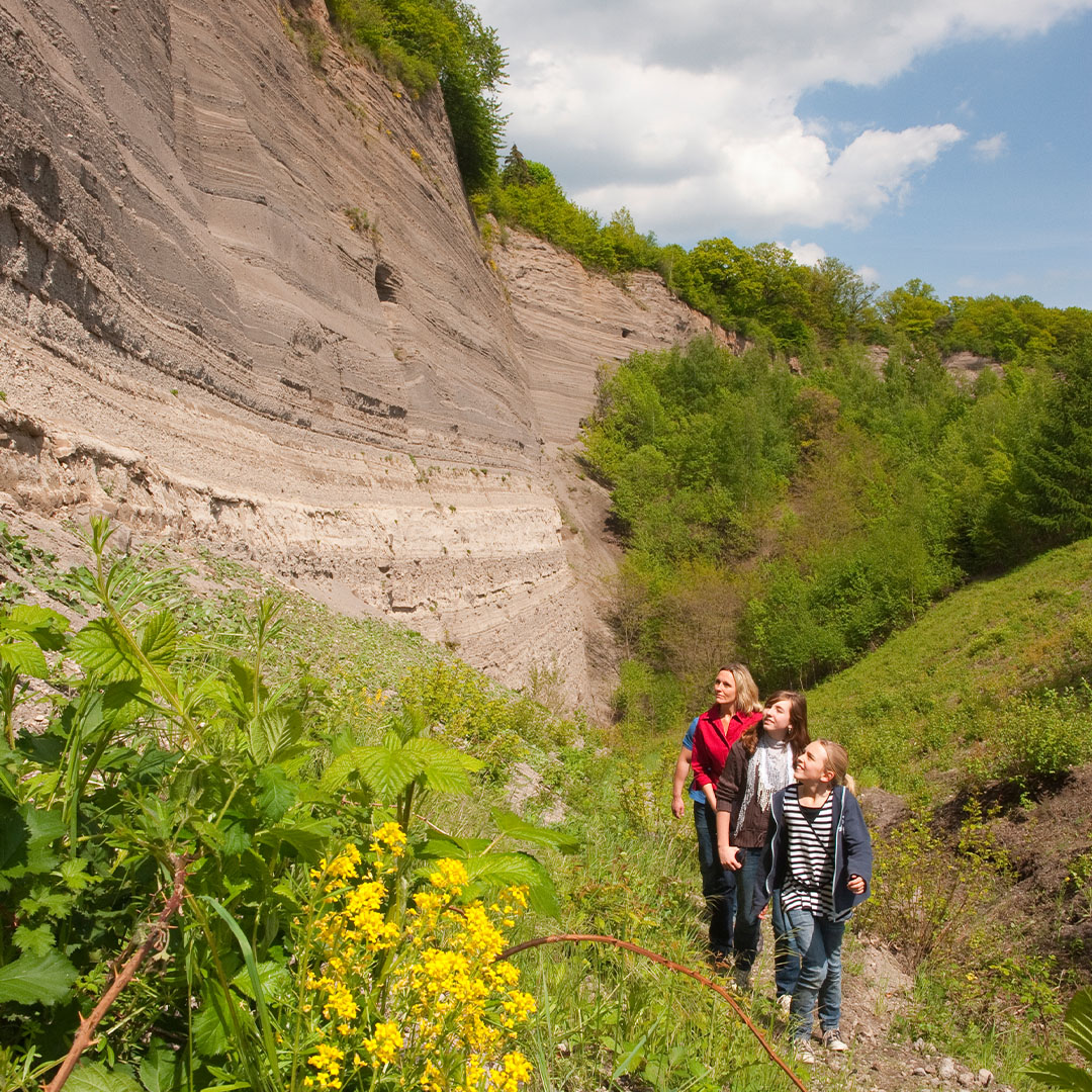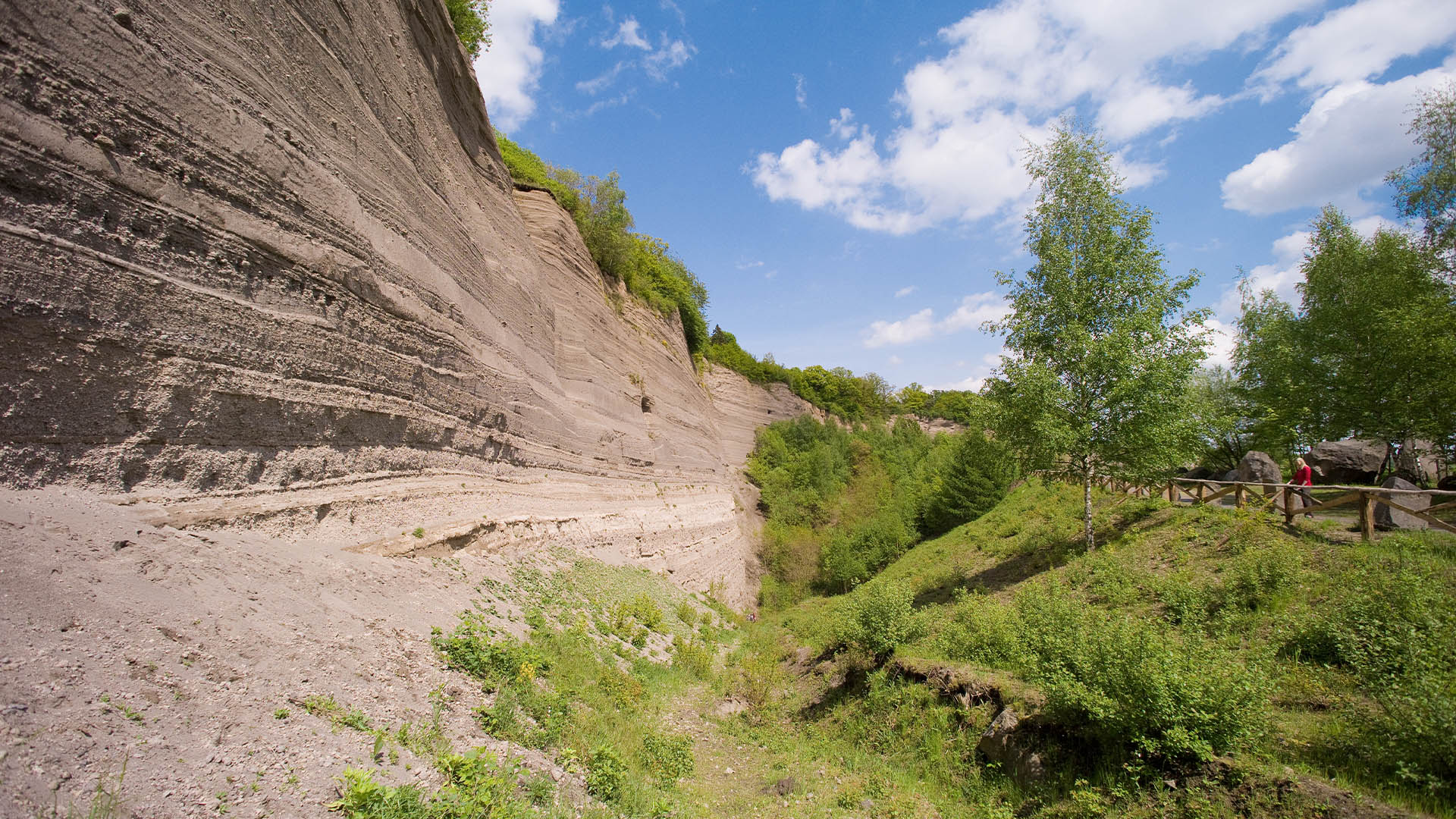
WINGERT´S ROCK FACE
Europe’s greatest pumice rock face
The ground splits open and an enormous hot cloud rises threateningly in the sky. Lighting crackles, illuminating the darkness of the night. Thunder crashes. Rain pounds. Stones pelt down from the cloud to the ground below. A torrent of fire engulfs the land. Lava bombs explode. A volcanic eruption is destroying the East Eifel region. This devastating event occurred in springtime around 13,000 years ago. The eruption of the Lake Laacher See volcano was one of the most violent in the early geological history of Central Europe.
Once upon a time…
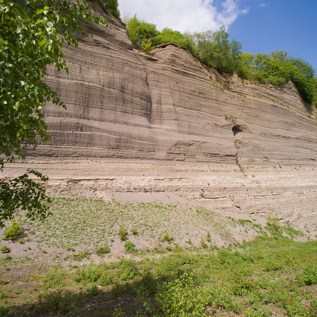
Today scientists can say with certainty what happened around 13,000 years ago when the Lake Laacher See volcano erupted. Soil exploration at Wingertsbergwand near Mendig has allowed them to explain the history of the Lake Laacher See eruption by comparing samples with soil from currently active volcanoes. Vegetation discovered under the tuff and pumice deposits has allowed them to deduce what the East Eifel region looked like before the catastrophe.
Oaks, lindens, pines, willows and hazelnut bushes once covered the ground in the East Eifel region. It was an idyllic landscape. The climate was damp and cool, similar to the conditions found in Central Sweden today. The catastrophe occurred within just a few seconds and a devastating shock wave destroyed the original landscape.
WHAT HAPPENED?
Hot magma – molten stone – with a temperature of 1,300°C had surged into the upper parts of the Earth’s crust. For thousands of years it had bubbled away in a giant magma chamber. It then rose higher and higher up to the surface. Catastrophe was imminent. The molten mass of magma immediately hit ground water just below the Earths surface, and the resulting steam created a destructive build-up of pressure. This expanded explosively and blew apart the upper section of the Earth’s crust. The volcano erupted and catapulted ash, pumice, lava bombs and gases from the crater at supersonic speed.
The magma
Clouds of volcanic ash formed and were blown towards the east. From the ash clouds, fallout material rained down onto the ground below covering hills and valleys like a shroud. At the same time, enormous lumps of rock were ejected from the crater landing up to 3 km away.
Torrents of fire, 600°C hot, and streams of ash shot over the land at high speed, leaving behind a barren lunar landscape. In the main phase of the eruption, the material flew up to 40 km high. Clouds of ash carried the pumice more than 50 km down the River Rhine. The finest particles of ash were carried as far as Northern Italy and Southern Sweden.
In the subsequent eruption phase, minerals from the bottom of the magma chamber – including the famous hauynite – were blasted into the sky.
The late eruption phase
In the late eruption phase, new destructive torrents of fire covered the land once again. Today, fine-grained, dune-like pyroclastic falls are testimony to this event. Hurricane-like rainfall dislodged streams of mud, which annihilated the land with the same power as the ash streams.
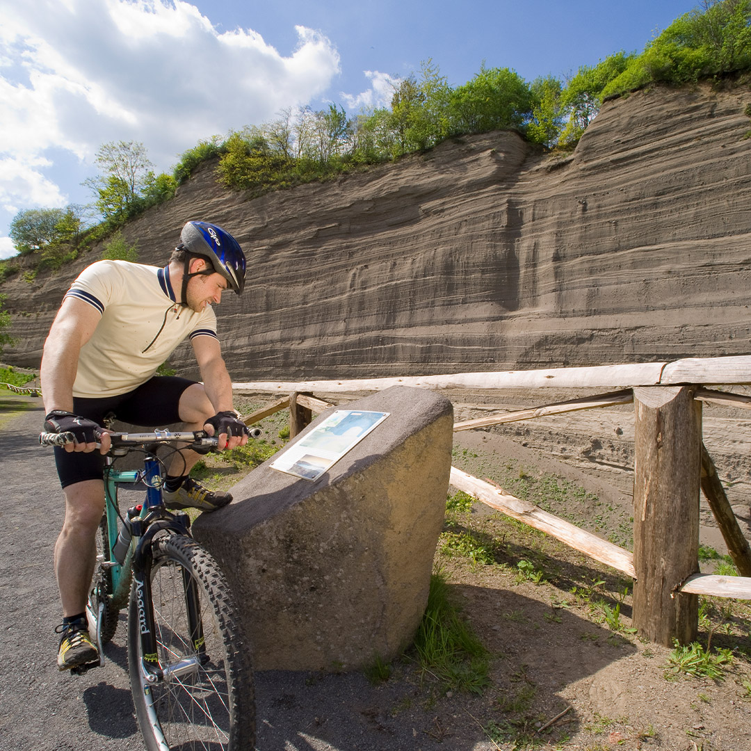
The inferno created by the Lake Laacher See eruption lasted 10 days. Today, 13,000 years later, you can see the traces left by this natural disaster at Wingertsbergwand and feel the magnitude of this historic event. Visit the 50-metre-high rock face and find out how the landscape was created by following the self-guided walking tour. Just a few minutes away from Wingertsbergwand is Lake Laacher See, a unique nature reserve with a panoramic hiking trail and home to a Benedictine abbey. From the “Schafes Knüppchen” viewing point, you can enjoy a wonderful view over this beautiful landscape.